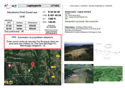


LF1952 - Lagleygeolle
Located in Lagleygeolle, France
ICAO - , IATA -
Data provided by AirmateGeneral information
Coordinates: N45°4'49" E1°40'24"
Elevation is 1380 feet MSL.
View others Airports in Limousin
Operational data
Special qualification required
Current time UTC:
Current local time:
Communications frequencies: [VIEW]
Runways:
| RWY identifier | QFU | Length (ft) | Width (ft) | Surface | LDA (ft) |
| 07 | 0° | 1410 | 65 | GRASS | |
| 25 | 0° | 1410 | 65 | GRASS |
Airport contact information
Address: Lagleygeolle France