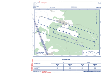
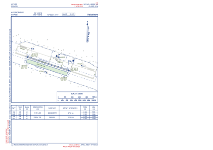


EPPG - Kakolewo
Located in , Poland
ICAO - , IATA -
Data provided by AirmateGeneral information
Coordinates: N52°14'6" E16°14'28"
Elevation is 331 feet MSL.
View others Airports in Greater Poland
Operational data
Special qualification required
Current time UTC:
Current local time:
Communications frequencies: [VIEW]
Runways:
| RWY identifier | QFU | Length (ft) | Width (ft) | Surface | LDA (ft) |
| 10R | 0° | 3904 | 328 | UNK | |
| 28L | 0° | 3904 | 328 | UNK | |
| 10L | 0° | 3904 | 98 | UNK | |
| 28R | 0° | 3904 | 98 | UNK |
Airport contact information
Address: Poland