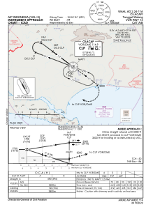
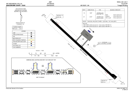


WAHL - Cilacap / Tunggul Wulung
Located in Cilacap, Indonesia
ICAO - , IATA - CXP
Data provided by AirmateGeneral information
Coordinates: S7°38'40" E109°2'5"
Elevation is 84 feet MSL.
View others Airports in Jawa Tengah
Operational data
Special qualification required
Current time UTC:
Current local time:
Weather at : - ( 0 km )
METAR: PASA 262318Z AUTO 23003KT 1 3/4SM UP BR OVC003 01/00 A2989 RMK AO2 P0000 FZRANO
Communications frequencies: [VIEW]
Runways:
| RWY identifier | QFU | Length (ft) | Width (ft) | Surface | LDA (ft) |
| 13 | 133° | 4593 | 98 | UNK | |
| 31 | 313° | 4593 | 98 | UNK |
Airport contact information
Address: Cilacap Indonesia