


W40 - Mount Olive Muni
Located in Mount Olive, United States
ICAO - W40, IATA -
Data provided by AirmateGeneral information
Coordinates: N35°13'17" W78°2'19"
Elevation is 167 feet MSL.
Magnetic variation is -09° East View others Airports in North Carolina
Operational data
Special qualification required
Current time UTC:
Current local time:
Weather at : KGSB - Seymour Johnson Afb ( 15 km )
METAR: KGSB 191455Z 15006KT 10SM SCT018 SCT250 21/14 A3003 RMK AO2A SLP172 T02090141 50001
TAF: TAF KGSB 191200Z 1912/2018 09009KT 9999 OVC008 QNH3000INS BECMG 1913/1914 12012KT 9999 OVC010 QNH2999INS BECMG 1914/1915 14012KT 9999 BKN015 QNH2998INS BECMG 1915/1916 16012KT 9999 SCT020 BKN040 BKN250 QNH2988INS TEMPO 1922/2001 21010G25KT 4800 -TSRA SCT009 BKN020CB BECMG 2000/2001 25006KT 9999 BKN015 BKN120 BKN220 QNH2984INS BECMG 2009/2010 29009KT 9999 BKN006 BKN100 QNH2985INS BECMG 2014/2015 35010G15KT 9999 BKN024 QNH2987INS TX30/1920Z TN15/1912Z
Communications frequencies: [VIEW]
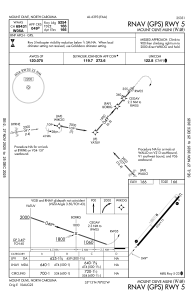
Runways:
| RWY identifier | QFU | Length (ft) | Width (ft) | Surface | LDA (ft) |
| 05 | 40° | 5254 | 75 | ASPH | |
| 23 | 220° | 5254 | 75 | ASPH |
Airport contact information
Address: Mount Olive United States
