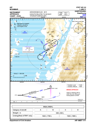
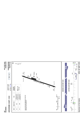


VYKT - Kawthoung
Located in Kawthoung, Myanmar
ICAO - VYKT, IATA - KAW
Data provided by AirmateGeneral information
Coordinates: N10°2'59" E98°32'17"
Elevation is 41 feet MSL.
View others Airports in Tanintharyi Division
Operational data
Special qualification required
Current time UTC:
Current local time:
Weather at : VTSR - Ranong / Ranong Airport ( 31 km )
TAF: TAF VTSR 281700Z 2818/2918 00000KT 9999 SCT020 BECMG 2902/2904 30006KT BECMG 2916/2918 00000KT
Communications frequencies: [VIEW]
Runways:
| RWY identifier | QFU | Length (ft) | Width (ft) | Surface | LDA (ft) |
| 02 | 18° | 6001 | 151 | ASP | |
| 20 | 198° | 6001 | 151 | ASP |
Airport contact information
Address: Kawthoung Myanmar