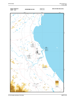
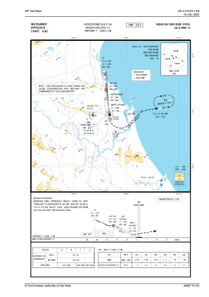
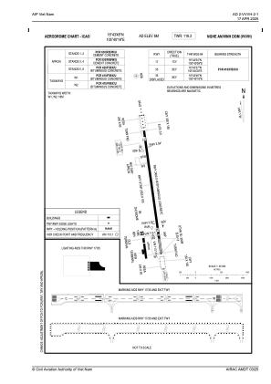


VVVH - Vinh Airport
Located in Vinh, Viet Nam
ICAO - VVVH, IATA - VII
Data provided by AirmateGeneral information
Coordinates: N18°43'48" E105°40'18"
Elevation is 23 feet MSL.
View others Airports in Thua Thien-Hue
Operational data
Special qualification required
Current time UTC:
Current local time:
Communications frequencies: [VIEW]
Runways:
| RWY identifier | QFU | Length (ft) | Width (ft) | Surface | LDA (ft) |
| 17 | 0° | 7875 | 148 | ASP | |
| 35 | 0° | 7875 | 148 | ASP |
Airport contact information
Address: Vinh Viet Nam