


UHMD - Provideniya Bay
Located in Provideniya, Russian Federation
ICAO - UHMD, IATA - PVS
Data provided by AirmateGeneral information
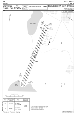
Coordinates: N64°22'44" W173°14'33"
Elevation is 71 feet MSL.
View others Airports in Chukotka Autonomous Okrug
Operational data
Special qualification required
Current time UTC:
Current local time:
Weather
METAR: UHMD 080230Z 08002MPS CAVOK M09/M16 Q1010 RMK QFE757/1010
TAF: TAF UHMD 080156Z 0803/0809 02003G08MPS 9999 FEW015 SCT025 TEMPO 0803/0809 5000 BR SCT007 BKN017
Communications frequencies: [VIEW]
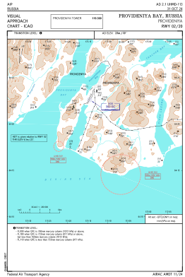
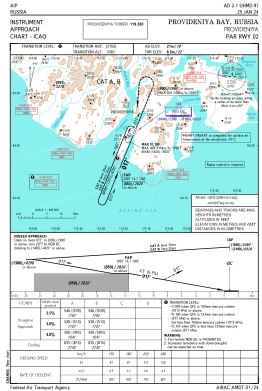
Runways:
| RWY identifier | QFU | Length (ft) | Width (ft) | Surface | LDA (ft) |
| 02 | 21° | 6562 | 171 | UNK | |
| 20 | 202° | 6562 | 171 | UNK |
Airport contact information
Address: Provideniya Russian Federation