


RPLB - Subic Bay International Airport
Located in Subic Bay, Philippines
ICAO - RPLB, IATA - SFS
Data provided by AirmateGeneral information
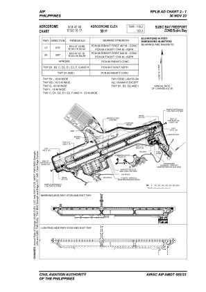
Coordinates: N14°47'40" E120°16'17"
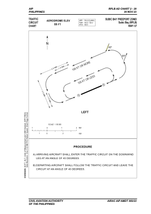
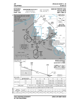
Elevation is 59 feet MSL.
Magnetic variation is -3° East View others Airports in Zambales
Operational data
Special qualification required
Current time UTC:
Current local time:
Weather
METAR: RPLB 051900Z 05005KT 9999 FEW020 27/24 Q1010 NOSIG RMK A2983
TAF: TAF RPLB 051700Z 0518/0618 10004KT 9999 FEW020 TX38/0606Z TN25/0521Z TEMPO 0518/0524 SCT020
Communications frequencies: [VIEW]
Runways:
| RWY identifier | QFU | Length (ft) | Width (ft) | Surface | LDA (ft) |
| 07 | 67° | 9006 | 148 | CONC | 9006 |
| 25 | 247° | 9006 | 148 | CONC | 9006 |
Airport contact information
Address: Subic Bay Philippines