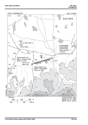
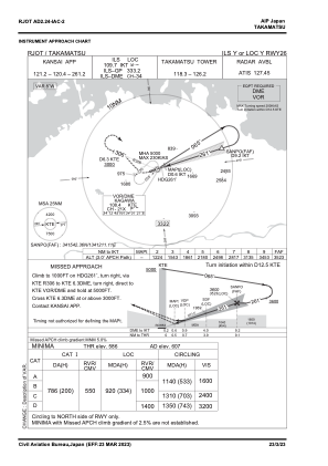
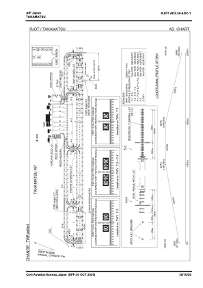


RJOT - Takamatsu
Located in Takamatsu, Japan
ICAO - RJOT, IATA - TAK
Data provided by AirmateGeneral information
Coordinates: N34°12'51" E134°0'56"
Elevation is 607 feet MSL.
View others Airports in Kagawa Prefecture
Operational data
Special qualification required
Current time UTC:
Current local time:
Weather
TAF: TAF RJOT 281705Z 2818/3000 04005KT 9999 FEW008 SCT050 TEMPO 2902/2905 4000 -RA BR FEW003 BKN008 BKN020 TEMPO 2905/2909 3000 SHRA BR BCFG FEW000 SCT002 BKN005 TEMPO 2909/2915 FEW003 BKN008 BKN015 BECMG 2912/2915 24006KT TEMPO 2915/3000 1500 -SHRA BR BCFG FEW000 SCT002 BKN003
Communications frequencies: [VIEW]
Runways:
| RWY identifier | QFU | Length (ft) | Width (ft) | Surface | LDA (ft) |
| 08 | 73° | 8202 | 197 | ASP | |
| 26 | 253° | 8202 | 197 | ASP |
Airport contact information
Address: Takamatsu Japan