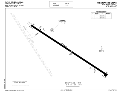


MMPG - Piedras Negras Aeropuerto Internacional
Located in Piedras Negras, Mexico
ICAO - MMPG, IATA - PDS
Data provided by AirmateGeneral information
Coordinates: N28°37'39" W100°32'4"
Elevation is 901 feet MSL.
View others Airports in Coahuila
Operational data
Special qualification required
Current time UTC:
Current local time:
Communications frequencies: [VIEW]
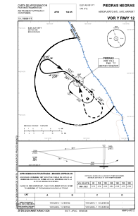
Runways:
| RWY identifier | QFU | Length (ft) | Width (ft) | Surface | LDA (ft) |
| 12 | 127° | 6726 | 105 | ASP | |
| 30 | 307° | 6726 | 105 | ASP |
Airport contact information
Address: Piedras Negras Mexico