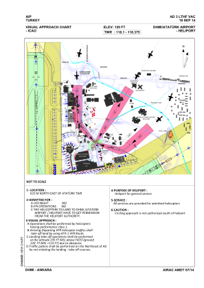
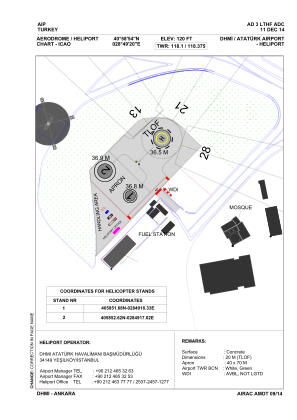


LTHF - Dhmi Ataturk Heliport
Located in Istanbul, Turkey
ICAO - , IATA -
Data provided by AirmateGeneral information
Coordinates: N40°58'54" E28°49'20"
Elevation is 120 feet MSL.
Magnetic variation is 4° East View others Airports in Istanbul
Operational data
Special qualification required
Current time UTC:
Current local time:
Weather at : LTBX - Istanbul Samandira ( 33 km )
TAF: TAF LTBX 271340Z 2715/2724 06018KT 9999 SCT027 TEMPO 2715/2716 06020G30KT BECMG 2716/2719 BKN007 BECMG 2719/2721 06008KT
Communications frequencies: [VIEW]
Runways:
Airport contact information
Address: Istanbul Turkey