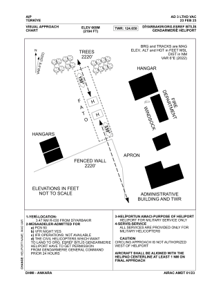
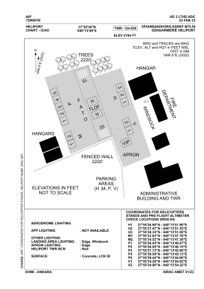


LTHD - Diyarbakir Orgeneral Esref Bitlis Gendarmerie Heliport
Located in Diyarbakir, Turkey
ICAO - , IATA -
Data provided by AirmateGeneral information
Coordinates: N37°55'36" E40°13'49"
Elevation is 2194 feet MSL.
Magnetic variation is 6.0° East View others Airports in Diyarbakir
Operational data
Special qualification required
Current time UTC:
Current local time:
Weather at : LTCC - Diyarbakir ( 5 km )
METAR: LTCC 291350Z 08004KT 040V110 CAVOK 31/10 Q1013 NOSIG RMK RWY16 04005KT 340V100 SKC
TAF: TAF LTCC 291040Z 2912/3012 VRB02KT CAVOK
Communications frequencies: [VIEW]
Runways:
| RWY identifier | QFU | Length (ft) | Width (ft) | Surface | LDA (ft) |
| 15 | 0° | 689 | 164 | UNK | |
| 33 | 0° | 689 | 164 | UNK |
Airport contact information
Address: Diyarbakir Turkey