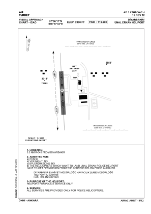
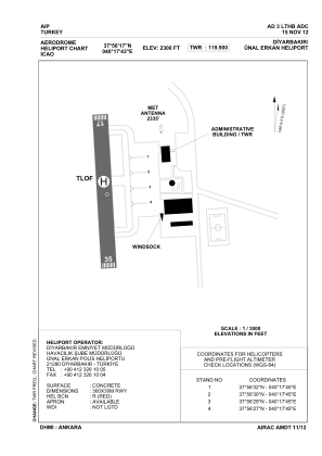


LTHB - Diyarbakir Unal Erkan Police Heliport
Located in Diyarbakir, Turkey
ICAO - , IATA -
Data provided by AirmateGeneral information
Coordinates: N37°56'17" E40°17'43"
Elevation is 2300 feet MSL.
Magnetic variation is 4.29° East View others Airports in Diyarbakir
Operational data
Special qualification required
Current time UTC:
Current local time:
Weather at : LTCC - Diyarbakir ( 10 km )
METAR: LTCC 290750Z 07006KT 030V110 CAVOK 27/10 Q1016 NOSIG RMK RWY16 05006KT 360V130 3AC100
TAF: TAF LTCC 290440Z 2906/3006 VRB02KT CAVOK
Communications frequencies: [VIEW]
Runways:
Airport contact information
Address: Diyarbakir Turkey