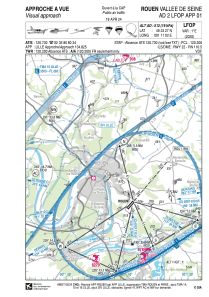
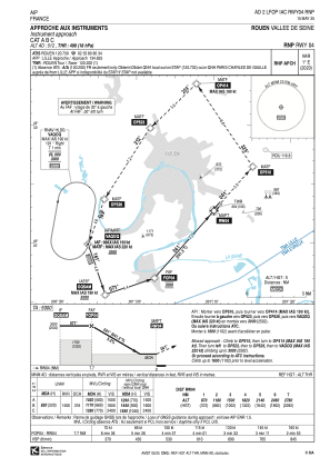
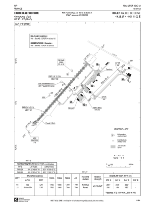


LFOP - Rouen Vallee De Seine
Located in Rouen, France
ICAO - LFOP, IATA - URO
Data provided by AirmateGeneral information
Coordinates: N49°23'27" E1°11'2"
Elevation is 512 feet MSL.
Magnetic variation is 0.63° East View others Airports in Upper Normandy
Operational data
Special qualification required
Current time UTC:
Current local time:
Communications frequencies: [VIEW]
Runways:
| RWY identifier | QFU | Length (ft) | Width (ft) | Surface | LDA (ft) |
| 05 | 47° | 2953 | 262 | GRASS | 2461 |
| 23 | 227° | 2953 | 262 | GRASS | 1870 |
| 04 | 41° | 5577 | 148 | BITUM | 5577 |
| 22 | 221° | 5577 | 148 | BITUM | 5577 |
Airport contact information
Address: Rouen France


