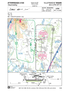
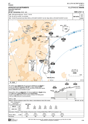
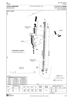


LFHV - Villefranche Tarare
Located in Villefranche, France
ICAO - LFHV, IATA - XVF
Data provided by AirmateGeneral information
Coordinates: N45°55'12" E4°38'6"
Elevation is 1076 feet MSL.
Magnetic variation is 1.76° East View others Airports in Rhône Alpes
Operational data
Special qualification required
Current time UTC:
Current local time:
Communications frequencies: [VIEW]
Runways:
| RWY identifier | QFU | Length (ft) | Width (ft) | Surface | LDA (ft) |
| 18 | 181° | 3412 | 98 | ASPH | 3074 |
| 36 | 1° | 3412 | 98 | ASPH | 3274 |
| 18L | 181° | 2887 | 197 | GRASS | 2887 |
| 36R | 1° | 2887 | 197 | GRASS | 2887 |
Airport contact information
Address: Villefranche France


