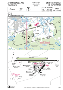
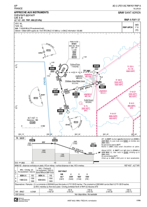
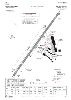


LFEV - Gray Saint Adrien
Located in Gray, France
ICAO - LFEV, IATA -
Data provided by AirmateGeneral information
Coordinates: N47°25'56" E5°37'17"
Elevation is 685 feet MSL.
Magnetic variation is 2.00° East View others Airports in Franche-Comté
Operational data
Special qualification required
Current time UTC:
Current local time:
Communications frequencies: [VIEW]
Runways:
| RWY identifier | QFU | Length (ft) | Width (ft) | Surface | LDA (ft) |
| 07L | 75° | 2822 | 262 | GRASS | 2822 |
| 25R | 255° | 2822 | 262 | GRASS | 2822 |
| 07R | 75° | 1148 | 66 | GRASS | 1148 |
| 25L | 255° | 1148 | 66 | GRASS | 1148 |
| 07 | 75° | 3363 | 75 | ASPH | 3363 |
| 25 | 255° | 3363 | 75 | ASPH | 3363 |
Airport contact information
Address: Gray France


