


LESALO - El Salobral (Vaalle Ambl
Located in Salobral, Spain
ICAO - , IATA -
Data provided by AirmateGeneral information
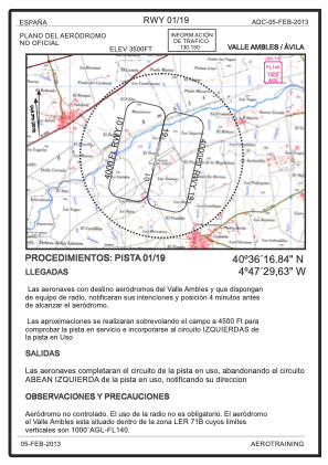
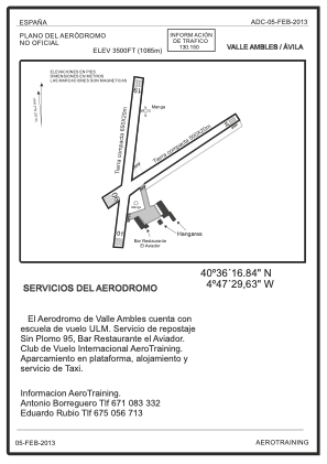
Coordinates: N40°36'16" W4°47'31"
Elevation is 3558 feet MSL.
Magnetic variation is 0° East View others Airports in Ávila
Operational data
Special qualification required
Current time UTC:
Current local time:
Weather at : LESA - Salamanca/Matacan ( 71 km )
METAR: LESA 262030Z AUTO 22012KT 200V260 CAVOK 11/05 Q1000
TAF: TAF LESA 262000Z 2621/2721 22013KT 9999 SCT040 TX12/2715Z TN05/2706Z PROB40 TEMPO 2622/2706 4000 RA SHRA SCT030TCU TEMPO 2703/2705 25018G30KT TEMPO 2705/2707 VRB05KT TEMPO 2709/2717 SCT030TCU TEMPO 2712/2714 23015G25KT PROB40 TEMPO 2714/2721 4000 RA SHRA SCT030TCU BECMG 2719/2721 VRB05KT
Communications frequencies: [VIEW]
Runways:
| RWY identifier | QFU | Length (ft) | Width (ft) | Surface | LDA (ft) |
| 01 | 7° | 1716 | 60 | DIRT | |
| 19 | 187° | 1716 | 60 | DIRT | |
| 06 | 56° | 1544 | 58 | DIRT | |
| 24 | 236° | 1544 | 58 | DIRT |
Airport contact information
Address: Salobral Spain
