


KUUU - Newport State
Located in Newport, United States
ICAO - UUU, IATA - NPT
Data provided by AirmateGeneral information
Coordinates: N41°31'57" W71°16'54"
Elevation is 171 feet MSL.
Magnetic variation is -15° East View others Airports in Rhode Island
Operational data
Special qualification required
Current time UTC:
Current local time:
Weather
METAR: KUUU 190253Z AUTO 01006KT 10SM OVC049 06/04 A3019 RMK AO2 SLP222 60000 T00560044 53005
Communications frequencies: [VIEW]
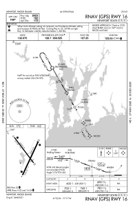
Runways:
| RWY identifier | QFU | Length (ft) | Width (ft) | Surface | LDA (ft) |
| 04 | 24° | 2999 | 75 | ASPH | |
| 22 | 204° | 2999 | 75 | ASPH | |
| 16 | 144° | 2623 | 75 | ASPH | |
| 34 | 324° | 2623 | 75 | ASPH |
Airport contact information
Address: Newport United States
