


KUIL - Quillayute
Located in Quillayute, United States
ICAO - UIL, IATA -
Data provided by AirmateGeneral information
Coordinates: N47°56'12" W124°33'45"
Elevation is 194 feet MSL.
Magnetic variation is 21° East View others Airports in Washington
Operational data
Special qualification required
Current time UTC:
Current local time:
Weather
METAR: KUIL 260553Z AUTO VRB04KT 10SM -RA BKN006 BKN013 OVC029 11/09 A2970 RMK AO2 SLP057 P0003 60037 T01110089 10128 20111 51017
Communications frequencies: [VIEW]
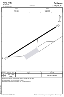
Runways:
| RWY identifier | QFU | Length (ft) | Width (ft) | Surface | LDA (ft) |
| 04 | 58° | 4211 | 100 | CONC | |
| 22 | 238° | 4211 | 100 | CONC |
Airport contact information
Address: Quillayute United States