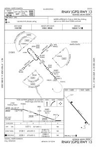


KHBC - Mohall Muni
Located in Mohall, United States
ICAO - HBC, IATA -
Data provided by AirmateGeneral information
Coordinates: N48°46'8" W101°32'16"
Elevation is 1650 feet MSL.
Magnetic variation is 09° East View others Airports in North Dakota
Operational data
Special qualification required
Current time UTC:
Current local time:
Weather at : KMIB - Minot Afb ( 41 km )
METAR: KMIB 201455Z 32014KT 10SM CLR 01/M07 A3034 RMK AO2A SLP299 T00131075 52002 $
Communications frequencies: [VIEW]
Runways:
| RWY identifier | QFU | Length (ft) | Width (ft) | Surface | LDA (ft) |
| 13 | 140° | 3600 | 75 | ASPH | |
| 31 | 320° | 3600 | 75 | ASPH |
Airport contact information
Address: Mohall United States