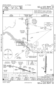


KDCU - Pryor Fld Rgnl
Located in Decatur, United States
ICAO - DCU, IATA - DCU
Data provided by AirmateGeneral information
Coordinates: N34°39'15" W86°56'43"
Elevation is 592 feet MSL.
Magnetic variation is -04° East View others Airports in Alabama
Operational data
Special qualification required
Current time UTC:
Current local time:
Weather
METAR: KDCU 182153Z AUTO 22010KT 10SM FEW034 BKN080 27/19 A3001 RMK AO2 LTG DSNT NE SLP158 T02670189
Communications frequencies: [VIEW]
Runways:
| RWY identifier | QFU | Length (ft) | Width (ft) | Surface | LDA (ft) |
| 18 | 181° | 6107 | 100 | ASPH | |
| 36 | 1° | 6107 | 100 | ASPH |
Airport contact information
Address: Decatur United States