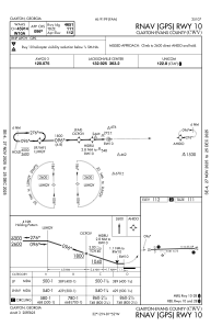


KCWV - Claxton-Evans County
Located in Claxton, United States
ICAO - CWV, IATA -
Data provided by AirmateGeneral information
Coordinates: N32°11'42" W81°52'10"
Elevation is 111 feet MSL.
Magnetic variation is -07° East View others Airports in Georgia
Operational data
Special qualification required
Current time UTC:
Current local time:
Weather
METAR: KCWV 190415Z AUTO 00000KT 10SM CLR 22/17 A3005 RMK AO2 T02180168
Communications frequencies: [VIEW]
Runways:
| RWY identifier | QFU | Length (ft) | Width (ft) | Surface | LDA (ft) |
| 10 | 89° | 5151 | 75 | ASPH | 5001 |
| 28 | 269° | 5151 | 75 | ASPH | 5151 |
Airport contact information
Address: Claxton United States