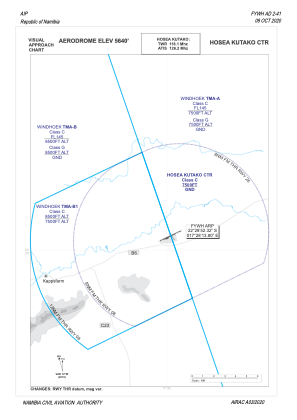
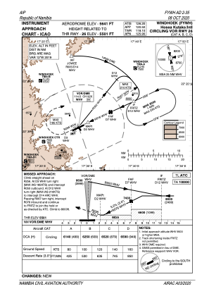
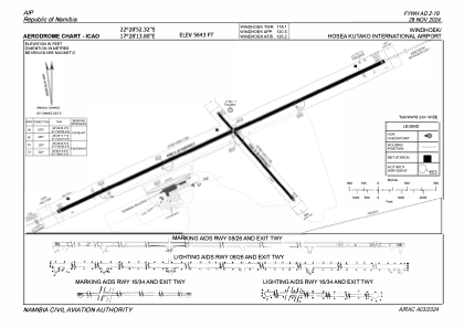


FYWH - Windhoek/Hosea Kutako Intl
Located in Windhoek, Namibia
ICAO - FYWH, IATA - WDH
Data provided by AirmateGeneral information
Coordinates: S22°28'48" E17°28'15"
Elevation is 5641 feet MSL.
View others Airports in Khomae
Operational data
Special qualification required
Current time UTC:
Current local time:
Weather
METAR: FYWH 300600Z 29005KT CAVOK 15/06 Q1024 NOSIG
TAF: TAF FYWH 300400Z 3006/0106 29007KT CAVOK BECMG 3007/3009 01006KT 9999 FEW050 BECMG 3010/3012 SCT050
Communications frequencies: [VIEW]
Runways:
| RWY identifier | QFU | Length (ft) | Width (ft) | Surface | LDA (ft) |
| 08 | 63° | 14990 | 148 | ASP | |
| 26 | 243° | 14990 | 148 | ASP | |
| 16 | 141° | 4997 | 98 | ASP | |
| 34 | 321° | 4997 | 98 | ASP |
Airport contact information
Address: Windhoek Namibia