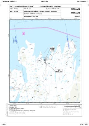
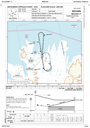
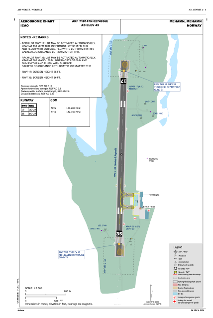


ENMH - Mehamn
Located in Mehamn, Norway
ICAO - ENMH, IATA - MEH
Data provided by AirmateGeneral information
Coordinates: N71°1'47" E27°49'36"
Elevation is 42 feet MSL.
Magnetic variation is 15.1° East View others Airports in Finnmark
Operational data
Special qualification required
Current time UTC:
Current local time:
Weather
METAR: ENMH 220650Z 31012KT 270V330 4000 -SN VV008 01/M01 Q1027
Communications frequencies: [VIEW]
Runways:
| RWY identifier | QFU | Length (ft) | Width (ft) | Surface | LDA (ft) |
| 17 | 0° | 3182 | 98 | ASP | |
| 35 | 0° | 3182 | 98 | ASP |
Airport contact information
Address: Mehamn Norway