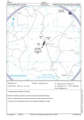
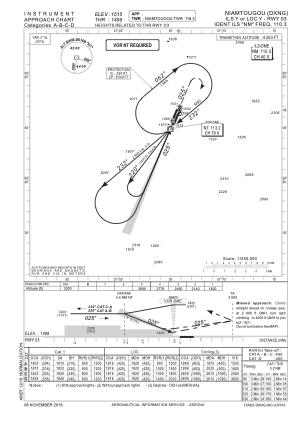
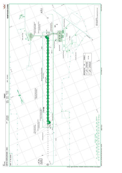


DXNG - Aeroport International De Niamtougou (Ain)
Located in Niamtougou, Togo
ICAO - DXNG, IATA - LRL
Data provided by AirmateGeneral information
Coordinates: N9°46'39" E1°5'44"
Elevation is 1515 feet MSL.
View others Airports in Kara Region
Operational data
Special qualification required
Current time UTC:
Current local time:
Weather
METAR: DXNG 061700Z 17006KT 9999 FEW010 34/19 Q1009
TAF: TAF COR DXNG 061700Z 0618/0718 20006KT 9999 FEW008 PROB30 TEMPO 0618/0622 TS PROB30 TEMPO 0708/0712 4000 TSRA BKN006 FEW016CB
Communications frequencies: [VIEW]
Runways:
| RWY identifier | QFU | Length (ft) | Width (ft) | Surface | LDA (ft) |
| 03 | 23° | 8202 | 148 | CON | |
| 21 | 203° | 8202 | 148 | CON |
Airport contact information
Address: Niamtougou Togo