


CZTA - Bloodvein River
Located in , Canada
ICAO - CZTA, IATA - YDV
Data provided by AirmateGeneral information
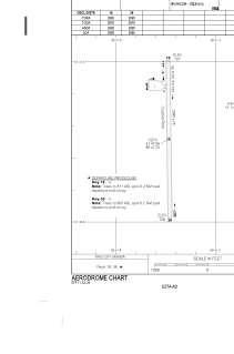
Coordinates: N51°47'4" W96°41'32"
Elevation is 730 feet MSL.
Magnetic variation is 2.5631° East View others Airports in Manitoba
Operational data
Special qualification required
Current time UTC:
Current local time:
Weather at : CYBV - Berens River ( 68 km )
METAR: CYBV 242000Z 19009G16KT 160V240 15SM FEW100 13/M03 A3006 RMK AC1 AC TR SLP192
Communications frequencies: [VIEW]
Runways:
| RWY identifier | QFU | Length (ft) | Width (ft) | Surface | LDA (ft) |
| 18 | 179° | 2994 | 75 | GRAVE | 2994 |
| 36 | 359° | 2994 | 75 | GRAVE | 2994 |
Airport contact information
Address: Canada