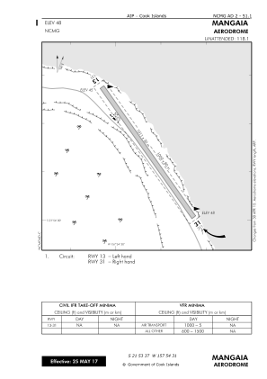


NCMG - Mangaia
Located in , Cook Islands
ICAO - NCMG, IATA - MGS
Data provided by AirmateGeneral information
Coordinates: S21°53'37" W157°54'31"
Elevation is 48 feet MSL.
View others Airports in (unassigned)
Operational data
Special qualification required
Current time UTC:
Current local time:
Communications frequencies: [VIEW]
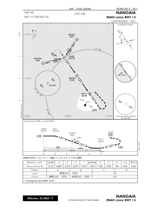
Runways:
| RWY identifier | QFU | Length (ft) | Width (ft) | Surface | LDA (ft) |
| 13 | 145° | 3317 | 98 | CORAL | 3317 |
| 31 | 325° | 3317 | 98 | CORAL | 3317 |
Airport contact information
Address: Cook Islands