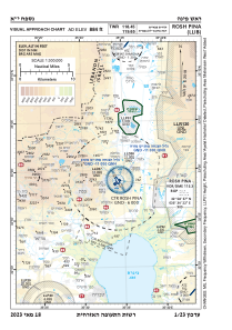
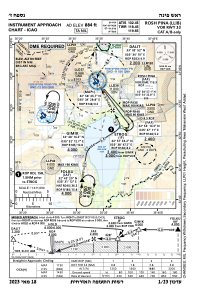
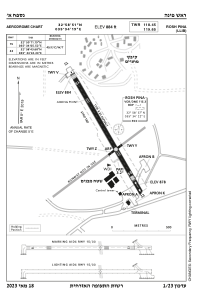


LLIB - Rosh Pina
Located in Mahanayim, Israel
ICAO - LLIB, IATA - RPN
Data provided by AirmateGeneral information
Coordinates: N32°58'52" E35°34'15"
Elevation is 884 feet MSL.
Magnetic variation is 5° East View others Airports in North District
Operational data
Special qualification required
Current time UTC:
Current local time:
Communications frequencies: [VIEW]
Runways:
| RWY identifier | QFU | Length (ft) | Width (ft) | Surface | LDA (ft) |
| 15 | 151° | 3655 | 100 | ASP | |
| 33 | 331° | 3655 | 100 | ASP |
Airport contact information
Address: Mahanayim Israel