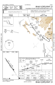


KCPU - Calaveras County-Maury Rasmussen Fld
Located in San Andreas, United States
ICAO - CPU, IATA -
Data provided by AirmateGeneral information
Coordinates: N38°8'46" W120°38'53"
Elevation is 1327 feet MSL.
Magnetic variation is 15° East View others Airports in California
Operational data
Special qualification required
Current time UTC:
Current local time:
Weather
METAR: KCPU 191515Z AUTO 00000KT 10SM CLR 14/09 A2995 RMK AO2 T01360093
Communications frequencies: [VIEW]
Runways:
| RWY identifier | QFU | Length (ft) | Width (ft) | Surface | LDA (ft) |
| 13 | 145° | 3602 | 60 | ASPH | |
| 31 | 325° | 3602 | 60 | ASPH |
Airport contact information
Address: San Andreas United States
