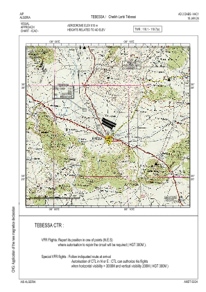
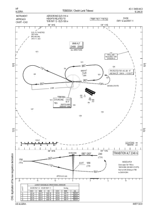
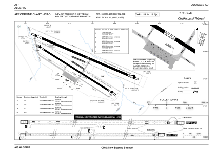


DABS - Tebessa / Cheikh Larbi Tebessi
Located in Tebessa, Algeria
ICAO - DABS, IATA - TEE
Data provided by AirmateGeneral information
Coordinates: N35°25'57" E8°7'32"
Elevation is 2657 feet MSL.
View others Airports in Tébessa Province
Operational data
Special qualification required
Current time UTC:
Current local time:
Weather
METAR: DABS 191600Z 32011KT CAVOK 16/M08 Q1019
TAF: TAF DABS 191100Z 1912/2012 34015KT 9999 SCT020 PROB30 TEMPO 1912/1920 FEW020TCU BECMG 1919/1921 24008KT
Communications frequencies: [VIEW]
Runways:
| RWY identifier | QFU | Length (ft) | Width (ft) | Surface | LDA (ft) |
| 11 | 113° | 9843 | 148 | ASP | |
| 29 | 293° | 9843 | 148 | ASP | |
| 12 | 124° | 7874 | 98 | ASP | |
| 30 | 304° | 7874 | 98 | ASP |
Airport contact information
Address: Tebessa Algeria