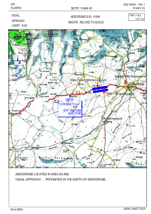
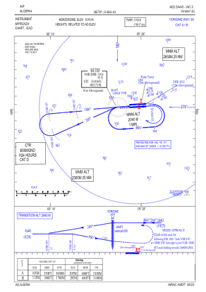
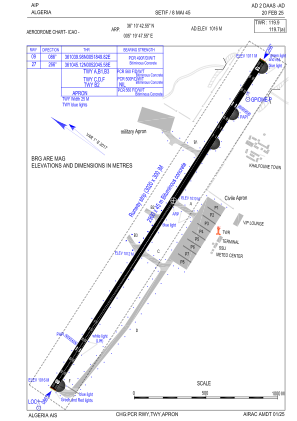


DAAS - Setif / 8 Mai 45
Located in Setif, Algeria
ICAO - DAAS, IATA - QSF
Data provided by AirmateGeneral information
Coordinates: N36°10'43" E5°19'48"
Elevation is 3333 feet MSL.
View others Airports in Sétif Province
Operational data
Special qualification required
Current time UTC:
Current local time:
Weather
METAR: DAAS 190400Z 36004KT 9999 FEW026 SCT233 07/03 Q1020
TAF: TAF DAAS 182300Z 1900/1924 04008KT 9999 SCT023 TEMPO 1900/1909 FEW020CB PROB30 TEMPO 1900/1905 4000 -RA FEW020CB
Communications frequencies: [VIEW]
Runways:
| RWY identifier | QFU | Length (ft) | Width (ft) | Surface | LDA (ft) |
| 09 | 87° | 9514 | 148 | UNK | |
| 27 | 267° | 9514 | 148 | UNK |
Airport contact information
Address: Setif Algeria