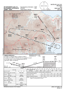
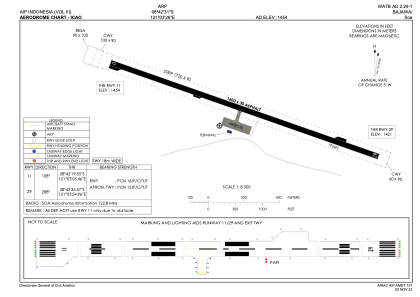


WATB - Bajawa / Soa
Located in Bajawa, Indonesia
ICAO - WATB, IATA - BJW
Data provided by AirmateGeneral information
Coordinates: S8°42'31" E121°3'26"
Elevation is 1454 feet MSL.
View others Airports in Nusa Tenggara Timur
Operational data
Special qualification required
Current time UTC:
Current local time:
Weather at : - ( 0 km )
METAR: MHTR 231310Z 00000KT 5000 RA BKN022TCU FEW024CB 26/23
Communications frequencies: [VIEW]
Runways:
| RWY identifier | QFU | Length (ft) | Width (ft) | Surface | LDA (ft) |
| 11 | 109° | 5249 | 98 | UNK | |
| 29 | 289° | 5249 | 98 | UNK |
Airport contact information
Address: Bajawa Indonesia