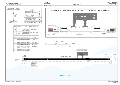


WAEH - Lelilef Sawai / Weda Bay
Located in Weda, Indonesia
ICAO - , IATA -
Data provided by AirmateGeneral information
Coordinates: N0°28'5" E127°56'46"
Elevation is 6 feet MSL.
View others Airports in Maluku Utara
Operational data
Special qualification required
Current time UTC:
Current local time:
Weather at : - ( 0 km )
METAR: OPLA 240125Z 01004KT 5000 FU NSC 21/15 Q1007 NOSIG RMK QFE981 A29.75
Communications frequencies: [VIEW]
Runways:
| RWY identifier | QFU | Length (ft) | Width (ft) | Surface | LDA (ft) |
| 09 | 91° | 5413 | 98 | UNK | |
| 27 | 271° | 5413 | 98 | UNK |
Airport contact information
Address: Weda Indonesia