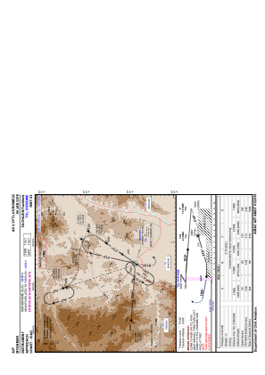


VYTL - Tachileik
Located in Tachileik, Myanmar
ICAO - VYTL, IATA - THL
Data provided by AirmateGeneral information
Coordinates: N20°29'5" E99°56'5"
Elevation is 1275 feet MSL.
View others Airports in Shan State
Operational data
Special qualification required
Current time UTC:
Current local time:
Communications frequencies: [VIEW]
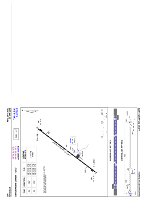
Runways:
| RWY identifier | QFU | Length (ft) | Width (ft) | Surface | LDA (ft) |
| 04 | 38° | 7051 | 98 | BIT | |
| 22 | 218° | 7051 | 98 | BIT |
Airport contact information
Address: Tachileik Myanmar