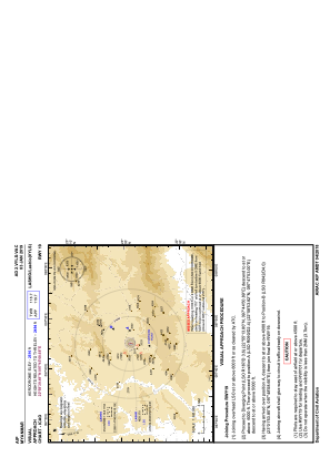
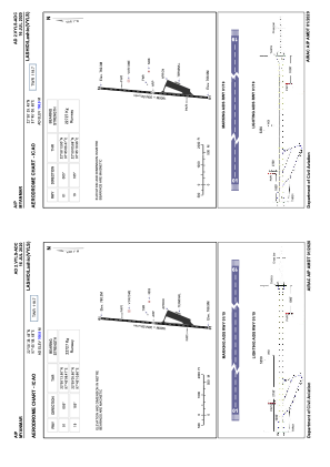


VYLS - Lashio
Located in Lashio, Myanmar
ICAO - VYLS, IATA - LSH
Data provided by AirmateGeneral information
Coordinates: N22°58'39" E97°45'9"
Elevation is 2516 feet MSL.
View others Airports in Shan State
Operational data
Special qualification required
Current time UTC:
Current local time:
Weather at : - ( 0 km )
METAR: PAPG 251013Z AUTO 00000KT 9SM -RA 06/06 A2994 RMK AO2 P0000
Communications frequencies: [VIEW]
Runways:
| RWY identifier | QFU | Length (ft) | Width (ft) | Surface | LDA (ft) |
| 01 | 5° | 5249 | 98 | BIT | |
| 19 | 185° | 5249 | 98 | BIT |
Airport contact information
Address: Lashio Myanmar