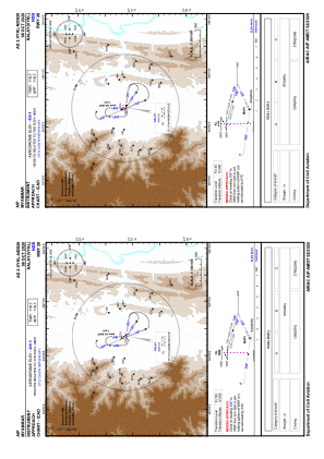
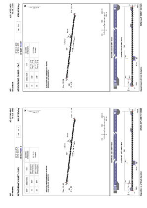


VYKL - Kalay
Located in Kalay, Myanmar
ICAO - VYKL, IATA - KMV
Data provided by AirmateGeneral information
Coordinates: N23°11'20" E94°3'4"
Elevation is 439 feet MSL.
View others Airports in Sagaing Division
Operational data
Special qualification required
Current time UTC:
Current local time:
Weather at : - ( 0 km )
METAR: KGYY 252145Z 06009KT 10SM CLR 10/05 A3027
Communications frequencies: [VIEW]
Runways:
| RWY identifier | QFU | Length (ft) | Width (ft) | Surface | LDA (ft) |
| 10 | 98° | 6998 | 98 | UNK | |
| 28 | 278° | 6998 | 98 | UNK |
Airport contact information
Address: Kalay Myanmar