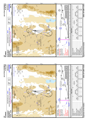
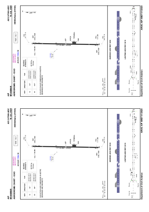


VYHH - Heho
Located in Heho, Myanmar
ICAO - VYHH, IATA - HEH
Data provided by AirmateGeneral information
Coordinates: N20°44'49" E96°47'31"
Elevation is 3935 feet MSL.
View others Airports in Shan State
Operational data
Special qualification required
Current time UTC:
Current local time:
Weather at : - ( 0 km )
METAR: PFCL 251533Z AUTO 13012KT 10SM BKN023 OVC041 02/ A2979 RMK AO2 FZRANO TSNO
Communications frequencies: [VIEW]
Runways:
| RWY identifier | QFU | Length (ft) | Width (ft) | Surface | LDA (ft) |
| 18 | 181° | 8501 | 151 | ASP | |
| 36 | 1° | 8501 | 151 | ASP |
Airport contact information
Address: Heho Myanmar