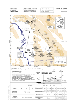
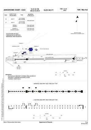


VTPM - Tak / Mae Sot Airport
Located in Tak, Thailand
ICAO - VTPM, IATA - MAQ
Data provided by AirmateGeneral information
Coordinates: N16°41'60" E98°33'0"
Elevation is 690 feet MSL.
View others Airports in Tak Province
Operational data
Special qualification required
Current time UTC:
Current local time:
Weather
TAF: TAF VTPM 242300Z 2500/2524 24008KT 8000 FEW035
Communications frequencies: [VIEW]
Runways:
| RWY identifier | QFU | Length (ft) | Width (ft) | Surface | LDA (ft) |
| 09 | 89° | 6890 | 148 | ASP | |
| 27 | 269° | 6890 | 148 | ASP |
Airport contact information
Address: Tak Thailand