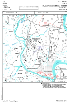
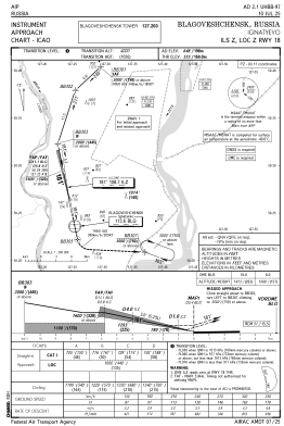
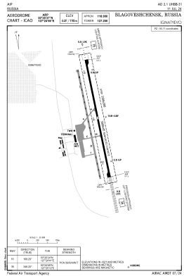


UHBB - Blagoveshchensk/Ignatyevo
Located in Blagoveshchensk, Russian Federation
ICAO - UHBB, IATA - BQS
Data provided by AirmateGeneral information
Coordinates: N50°25'32" E127°24'45"
Elevation is 640 feet MSL.
View others Airports in Amur Oblast
Operational data
Special qualification required
Current time UTC:
Current local time:
Weather
METAR: UHBB 251130Z 26004MPS 9999 SCT033CB 08/M00 Q0993 R36R/290257 NOSIG RMK QFE727/0970
TAF: TAF UHBB 251055Z 2512/2612 27006G13MPS 9999 BKN020CB BECMG 2522/2601 31008G14MPS SCT030CB
Communications frequencies: [VIEW]
Runways:
| RWY identifier | QFU | Length (ft) | Width (ft) | Surface | LDA (ft) |
| 18 | 168° | 9186 | 148 | ASP | |
| 36 | 348° | 9186 | 148 | ASP |
Airport contact information
Address: Blagoveshchensk Russian Federation