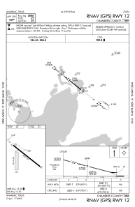


T00 - Chambers County
Located in Anahuac, United States
ICAO - T00, IATA -
Data provided by AirmateGeneral information
Coordinates: N29°46'11" W94°39'49"
Elevation is 21 feet MSL.
Magnetic variation is 05° East View others Airports in Texas
Operational data
Special qualification required
Current time UTC:
Current local time:
Communications frequencies: [VIEW]
Runways:
| RWY identifier | QFU | Length (ft) | Width (ft) | Surface | LDA (ft) |
| 12 | 129° | 3005 | 60 | ASPH | |
| 30 | 309° | 3005 | 60 | ASPH | |
| 17 | 180° | 1900 | 300 | GRASS | |
| 35 | 0° | 1900 | 300 | GRASS |
Airport contact information
Address: Anahuac United States