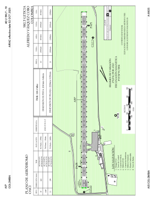


SKLT - Leticia-Alfredo Vasquez Cobo
Located in Leticia, Colombia
ICAO - SKLT, IATA - LET
Data provided by AirmateGeneral information
Coordinates: S4°11'33" W69°56'33"
Elevation is 270 feet MSL.
Magnetic variation is -10° East View others Airports in Amazonas
Operational data
Special qualification required
Current time UTC:
Current local time:
Weather
METAR: SKLT 161700Z 10003KT 9999 SCT015 32/26 Q1010
TAF: TAF SKLT 161630Z 1618/1718 09004KT 9999 SCT015 TEMPO 1700/1705 5000 TSRA BKN010CB TX33/1619Z TN22/1710Z
Communications frequencies: [VIEW]
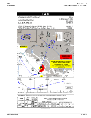
Runways:
| RWY identifier | QFU | Length (ft) | Width (ft) | Surface | LDA (ft) |
| 03 | 21° | 6594 | 131 | ASPH | 6594 |
| 21 | 201° | 6594 | 131 | ASPH | 6890 |
Airport contact information
Address: Leticia Colombia