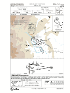
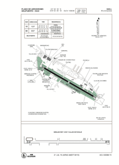


SESM - Shell / Rio Amazonas
Located in Shell Mera, Ecuador
ICAO - SESM, IATA - PTZ
Data provided by AirmateGeneral information
Coordinates: S1°30'19" W78°3'45"
Elevation is 3464 feet MSL.
Magnetic variation is -4° East View others Airports in Pastaza
Operational data
Special qualification required
Current time UTC:
Current local time:
Weather
METAR: SESM 241200Z 31003KT 9999 BKN030 OVC100 19/18 Q1018 RMK A3008
Communications frequencies: [VIEW]
Runways:
| RWY identifier | QFU | Length (ft) | Width (ft) | Surface | LDA (ft) |
| 12 | 120° | 5013 | 74 | ASPH | 4879 |
| 30 | 300° | 5013 | 74 | ASPH | 37687 |
Airport contact information
Address: Shell Mera Ecuador