


SBLS - Lagoa Santa
Located in Lagoa Santa, Brazil
ICAO - SBLS, IATA -
Data provided by AirmateGeneral information
Coordinates: S19°39'40" W43°53'52"
Elevation is 2795 feet MSL.
View others Airports in Minas Gerais
Operational data
Special qualification required
Current time UTC:
Current local time:
Weather
METAR: SBLS 251500Z 12007KT 030V140 9999 SCT030 28/18 Q1019
Communications frequencies: [VIEW]
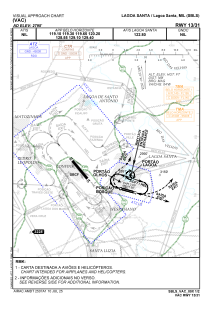
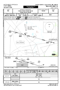
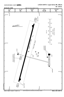
Runways:
| RWY identifier | QFU | Length (ft) | Width (ft) | Surface | LDA (ft) |
| 13 | 0° | 6037 | 98 | ASPH | |
| 31 | 0° | 6037 | 98 | ASPH |
Airport contact information
Address: Lagoa Santa Brazil