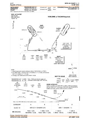


RKTH - Pohang Gyeongju / Domestic
Located in Pohang, Korea, Republic of
ICAO - RKTH, IATA - KPO
Data provided by AirmateGeneral information
Coordinates: N35°59'16" E129°25'7"
Elevation is 75 feet MSL.
Magnetic variation is -9° East View others Airports in Gyeongsangbugdo
Operational data
Special qualification required
Current time UTC:
Current local time:
Communications frequencies: [VIEW]
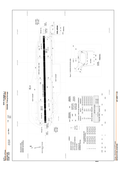
Runways:
| RWY identifier | QFU | Length (ft) | Width (ft) | Surface | LDA (ft) |
| 10 | 89° | 6998 | 151 | CON | |
| 28 | 269° | 6998 | 151 | CON |
Airport contact information
Address: Pohang Korea, Republic of