


NCAT - Atiu
Located in , Cook Islands
ICAO - NCAT, IATA - AIU
Data provided by AirmateGeneral information
Coordinates: S19°57'60" W158°7'31"
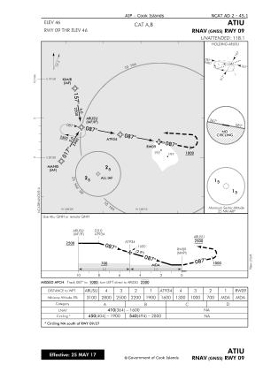
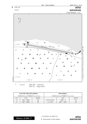
Elevation is 45 feet MSL.
View others Airports in (unassigned)
Operational data
Special qualification required
Current time UTC:
Current local time:
Weather
METAR: NCAT 162100Z AUTO NIL
Communications frequencies: [VIEW]
Runways:
| RWY identifier | QFU | Length (ft) | Width (ft) | Surface | LDA (ft) |
| 09 | 101° | 4117 | 98 | CORAL | 4117 |
| 27 | 281° | 4117 | 98 | CORAL | 4117 |
Airport contact information
Address: Cook Islands