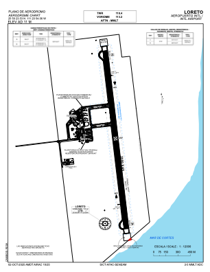


MMLT - Loreto, B.S.C. Aeropuerto Internacional
Located in Loreto, Mexico
ICAO - MMLT, IATA - LTO
Data provided by AirmateGeneral information
Coordinates: N25°59'24" W111°20'54"
Elevation is 34 feet MSL.
View others Airports in Baja California Sur
Operational data
Special qualification required
Current time UTC:
Current local time:
Weather
TAF: TAF MMLT 241654Z 2418/2518 02012KT P6SM BKN250 FM250600 00000KT P6SM BKN200
Communications frequencies: [VIEW]
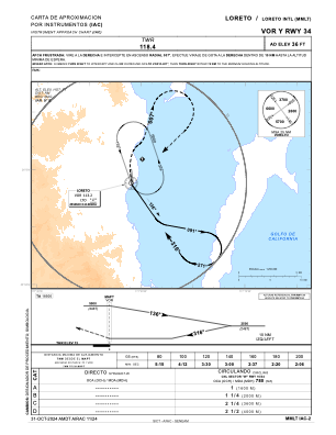
Runways:
| RWY identifier | QFU | Length (ft) | Width (ft) | Surface | LDA (ft) |
| 16 | 173° | 7218 | 148 | ASP | |
| 34 | 353° | 7218 | 148 | ASP |
Airport contact information
Address: Loreto Mexico