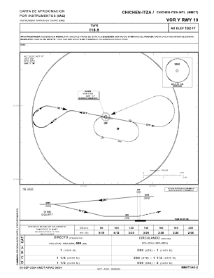
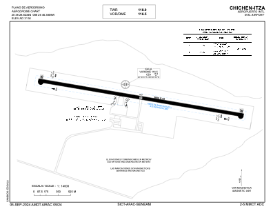


MMCT - Chichen-Itza Aeropuerto Internacional
Located in Chichen-Itza, Mexico
ICAO - MMCT, IATA - CZA
Data provided by AirmateGeneral information
Coordinates: N20°38'29" W88°26'46"
Elevation is 102 feet MSL.
View others Airports in Yucatan
Operational data
Special qualification required
Current time UTC:
Current local time:
Weather
METAR: MMCT 251847Z 09006KT 7SM SCT020 33/21 A2997 RMK 8/100 HZY MDT CU CI
Communications frequencies: [VIEW]
Runways:
| RWY identifier | QFU | Length (ft) | Width (ft) | Surface | LDA (ft) |
| 10 | 100° | 9186 | 148 | CON | |
| 28 | 280° | 9186 | 148 | CON |
Airport contact information
Address: Chichen-Itza Mexico