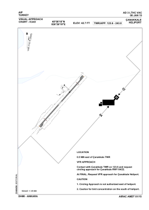
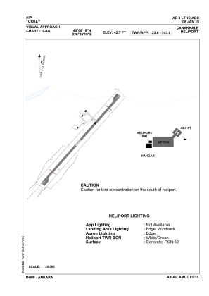


LTHC - Canakkale Military Heliport
Located in Canakkale, Turkey
ICAO - , IATA -
Data provided by AirmateGeneral information
Coordinates: N40°8'18" E26°26'19"
Elevation is 42 feet MSL.
Magnetic variation is 3.43° East View others Airports in Çanakkale
Operational data
Special qualification required
Current time UTC:
Current local time:
Weather at : LTBH - Canakkale ( 1 km )
METAR: LTBH 250750Z 25004KT 210V280 6000 NSC 20/15 Q1004
TAF: TAF LTBH 250740Z 2509/2518 22005KT 7000 NSC TEMPO 2511/2515 -SHRA BKN030
Communications frequencies: [VIEW]
Runways:
Airport contact information
Address: Canakkale Turkey