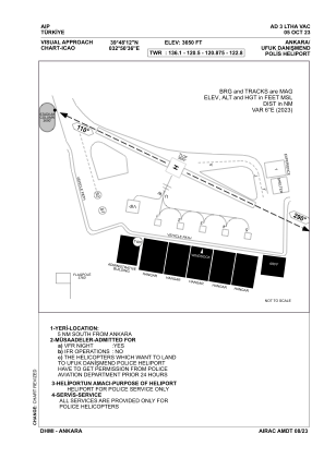
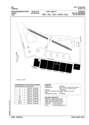


LTHA - Ankara Ufuk Danismend Police Heliport
Located in , Turkey
ICAO - , IATA -
Data provided by AirmateGeneral information
Coordinates: N39°48'12" E32°50'36"
Elevation is 3650 feet MSL.
Magnetic variation is 3.55° East View others Airports in Ankara
Operational data
Special qualification required
Current time UTC:
Current local time:
Weather at : LTAB - Ankara Guvercinlik ( 17 km )
TAF: TAF LTAB 250440Z 2506/2515 18009KT 9999 FEW040 SCT100 BKN200 TEMPO 2506/2508 -SHRA BKN035 BKN090 TEMPO 2509/2512 18015G30KT
Communications frequencies: [VIEW]
Runways:
Airport contact information
Address: Turkey