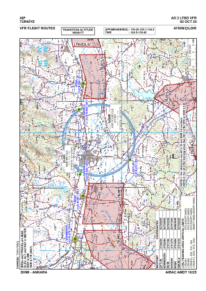
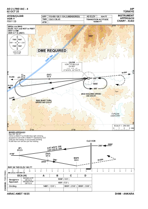
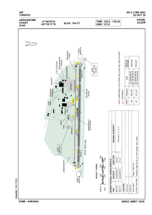


LTBD - Aydin Cildir
Located in Aydin, Turkey
ICAO - LTBD, IATA - CII
Data provided by AirmateGeneral information
Coordinates: N37°48'55" E27°53'17"
Elevation is 104 feet MSL.
Magnetic variation is 4.8° East View others Airports in Aydin
Operational data
Special qualification required
Current time UTC:
Current local time:
Weather
TAF: TAF LTBD 200440Z 2006/2015 VRB02KT 9999 -SHRA SCT035 BKN100 TEMPO 2009/2012 -TSRA FEW020CB BKN030 PROB30 TEMPO 2012/2015 -TSRA FEW020CB BKN030
Communications frequencies: [VIEW]
Runways:
| RWY identifier | QFU | Length (ft) | Width (ft) | Surface | LDA (ft) |
| 09 | 92° | 4708 | 98 | CONC | 4708 |
| 27 | 272° | 4708 | 98 | CONC | 4708 |
Airport contact information
Address: Aydin Turkey